Chuckanut Course Preview (er, sort of)

We were primed and ready for a preview of the Chuckanut course today! Packs ready, map at hand, and a waiting pan of lasagna at home (because I have learned from the mistake of not having awesome food at home post long run…) We were just getting ready to leave when our coach let us know she had to bail because of her very sick little girl (feel better, Fi!) Our schedules being what they are, we decided to give it a go on our own anyway. We’ve got a map, how hard could it be? <cue hand of fate>
Our drive up was perfect, and we enjoyed some podcasts on the way. I had used WTA to find the trailhead we needed, and Google Maps happily directed us there. Or so we thought… We knew we were headed to Fragrance Lake, so the signage at the beginning gave us no concerns. (Spoiler: We were at the wrong trailhead.)

We ran up this forest road, and after a mile, came to a fork. No signage. At all. We thought we knew where we were on the map, so off we went on the right fork. This forest road went on for (what seemed like) ages, and was an uphill slog. After a bit, we were rewarded with a viewpoint!

We kept on trucking, but after our watches dinged 3 miles, we suspected something was wrong. We pulled up Google Maps, just to see where the blue dot was in relation to the lake, and realized we were nowhere near Fragrance Lake. We had taken a wrong turn.


We turned around and when we got to the fork again, we went left. Then, hark, Fragrance Lake! We knew the trail we were looking for (Two Dollar Trail) was off the lake somewhere, so we went around the lake. No offshoot trail, wtf. There was another (unlabeled) trail nearby we were going to try, but then we encountered our Trail Angel #1 – a guy we had seen running up the road that we had turned around on. After some chatting, he very kindly explained where we had been, and what we were looking for. Once he told us how to spot the unlabeled Two Dollar Trail, we felt much better about our situation.
We found the Two Dollar Trail, and enjoyed it for the 3ish miles we were on it. Next, Cleater Road. An unlovely road that was another uphill (not steep) slog. When we were nearing the top, we knew we were looking for the Ridge Trail, but we now carried deep suspicions about the lack of signage. We thought we had found it, but luckily, we encountered our Trail Angel #2, who kindly pointed us in the right direction, and told us a bit more about the trail, and warned of the mountain biker trail offshoots. Got it. We also got a nice view before heading out on the Ridge Trail.

As we’d already had an unplanned 5 miles at the beginning of our run, we knew we wouldn’t be able to complete all of the sections we’d hoped on the trail. As the wind started to whip up on the ridge and the rain threatened, we decided we’d go a bit longer on the ridge and then turn around, so we could make time to hit up the “Chinscraper” hill before heading back to the car.
We got down the Cleater Road short section, and down a Fragrance Lake connector trail to where Chinscraper started. However, there were two trails, and drumroll, no signage. There were some cairns next to the bigger trail, so we thought that must be the real one. There were some hills on it, but nothing that seemed as ominous as we had expected. We went on for a bit, and then took another break to look at the map, and we figured out that we had, again, taken the wrong unlabeled trail. Back down we went…
We went back to the less traveled trail in time to encounter some mountain bikers. They recommended that we not hike up Chinscraper after all, because bikers bomb down that trail really fast. Ugh. We went up it just a bit, but as there were loads of blind corners on the narrow trail, and getting flattened by a set of knobby tires wasn’t on our to-do list, we turned around.
On our route back to the car, we took the trail to Fragrance Lake that we should have from the beginning and had no issues. After 5 hours, our workout was done. We gleefully ran toward our car that contained flip-flops (sweet foot relief), change of clothes (I only kind of smell now, but I’m dry!), and amazingly tasty Hawaiian pizza and a strawberry-banana Naked Juice (drool).
All in all, not quite the day that we had planned, but we did get a feel for different parts of the course, which really was the point. The weather was also decent and not rainy, which was a huge plus that aided our morale. The peekabo views of the Sound also helped.

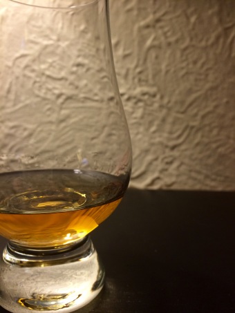
Since our big race in Scotland is to be followed up with lots of distillery visits and whisky drinking (sure to aid in recovery), we thought that to continue our training for Scotland, we should end our long run days with a well-earned dram of whisky. Excellent idea, right? 🙂


Comments
Chuckanut 50K Race Report | will run for whisky
March 21, 2016 at 3:39 am
[…] Lake Trail (pink): From our navigationally-challenged reconnaissance run here weeks ago, we were familiar with this section, and I’m glad we were. Switchbacks up…for a long […]