Zion National Park Runcation – Part 1

I realize Seattle is notorious for rain, but it’s been far rainier than normal this year. Even the born-and-raised Seattleites were being affected by the gloom. From October to March, we only had three sunny days. Three. To say that Adam and I were desperate for some sun and warmth is a gross understatement. Our remedy? A quick trip to Zion National Park!
We’d never been there before, but have previously enjoyed three other National Parks in Utah: Arches, Capitol Reef, and Bryce. We decided to make a runcation out of it. Okay, to be fair, I decided and Adam went along with it. 😉 My coach had recently run on the trails there, and gave us some great suggestions of routes to enjoy some miles and scenery.

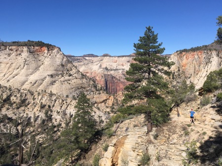
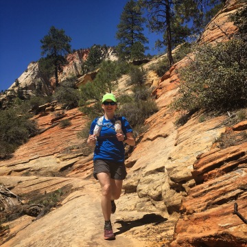
On our first day, we got up very early, and drove from Kanab to the East Rim Trailhead. It was a perfectly clear morning – a little chilly in the shadows of the canyons, but the sun was rapidly rising to warm us up. Since we live at about 400 feet above sea level in Seattle, we felt the altitude (5,700 feet) as soon as we started running. Altitude training for the win!
The first bit of the trail was partially in the woods, and it was wonderfully quiet. For the next few hours, we only saw a handful of backpackers and no one else but a single mule deer, a few hummingbirds, and a multitude of lizards. Perfect solitude. After nearly an hour, we came to a small waterfall that dropped into a canyon. It was the first canyon view of many on this trail.
At this point, the trail leveled out and we were in what looked like a meadow, of a sort. (There was even a bit of actual grass!) Very runnable and pleasant. We took a short detour (okay, a wrong turn) and found a wildlife trail camera. I’m sure we’re not the only dopes that show up on their camera, but we made sure to wave at the rangers!

I checked the map, and realized we took the wrong trail. Back we went, and no harm done (or extreme extra mileage). We were up on the rim of the canyons, and after about two hours of running the trail began to go steeply downhill. More rocks, and less vegetation, which also meant a bit more sunshine.

After about three hours, we came to a place where the trail seemed to disappear and we had to hunt for cairns to find our way. Sort of like a scavenger hunt for the trail.

At this point the stillness was broken with the sounds of people, and we came to a trail intersection. While enjoying a brief snack in the shade, I heard a loud drone sound. I looked up to see a hummingbird not two feet from my face, also enjoying a snack of his own. (From an Indian Paintbrush flower and not a Glutino cookie, though.) 😉
At this intersection, the East Rim Trail continues down into the main Zion Canyon that everyone knows and visits. However, we chose to join the tourists and took the other trail, which goes up to Observation Point. There is about a mile of switchbacks up to Observation Point, and it was noteworthy because it was sort of paved. Judging by some of the signatures in the broken concrete, it was “paved” with cement around 1975. It was an interesting juxtaposition to have a paved trail and a cairn-marked trail less than a mile apart. Once you get up those paved switchbacks, there’s nearly a mile of flat before you get to the main viewpoint.
Observation Point is north end of the canyon and, as the name suggests, gives an absolutely stunning view of the canyon.

After enjoying the view, taking a lot of photos, and having a snack, it was time to head back down.

Due to beautiful views, the altitude, and the heat, our run ended up taking substantially longer than we had intended (hoped?) We brought two liters of water each, and knew we were going to run out before the end. Luckily, we brought our water filter with us, and even more luckily, Stave Spring was flowing. Hooray!

After filling up, we had just over an hour left to run, and most of it was a gentle downhill. Just what we needed! We finished at the trailhead with 20 miles on our feet. What a great day!

The East Rim Trail is a great introduction to Zion’s charms without the crazy number of tourists that you encounter in Zion Canyon. I’m so glad this was our first trail in the park!
While the trail was mostly well-marked, I utilized the Trail Run Project app for a GPS map of this trail, and it worked beautifully! It provides a map of the trail, an elevation chart, and a blue dot of your location (most helpful when you get off course by a wildlife trail camera, for example.) I kept my phone in airplane mode until I needed to reference the map, and it was easy to turn it on to see where we were on the trail. Below is an example of a screenshot when we were on our way back.

I know not to rely on technology while out on the trails, but I’ll admit a huge fan of apps like this. (I have no orienteering skills, so what good is a map if you don’t know where you are on it?) I’ve used the Green Trails app in Washington, but I’m glad to find the Trail Run Project is nationwide (and even international, I think). I’d REALLY recommend it!

Our route – East Rim Trail to Observation Point (bottom right to upper left):

Day 1 of 2 of our adventures in Zion National Park was really fun and absolutely beautiful! Stay tuned for the Day 2 post when I go on a solo run before joining Adam for some fun hiking in the park…


Comments
Zion National Park Runcation – Part 2 | will run for whisky
April 26, 2017 at 6:16 am
[…] week we were lucky enough to be in Zion National Park for two days! (Read about our first day of adventures here.) Our first day included a 20 mile run that was great, but took up a large portion of the day. […]
Reflections and What’s Next? | will run for whisky
November 26, 2017 at 8:32 am
[…] day. I absolutely LOVED the portions of the trail I ran this past April (check out our runcation day 1 and day 2), so this run has been on my mind ever […]
2017 in Review – 2018 in Preview | will run for whisky
December 31, 2017 at 6:51 pm
[…] awesome runcation in Zion National Park (Day 1 and Day […]